測量調査事業
Acquiring the basic geographical information that is necessary for Geospatial survey business.
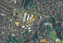
- Aerial photography
- Used for Geographical System, based on orthographic projection digital orthophotography, accumulate national large scale map;
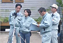
- Survey
-
Control point survey, leveling, line survey, river survey, in addition, sewage water, street, we carry a variety of survey, and all data is accumulated.
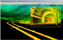
- 3-D measurements
- We use laser scanner techniques, deformed tunnel, cultural assets, 3-D city scenery measurement. These three dimensional measurement includes Laser profiler and mobile mapping data are one of our well-known business.