We consider Geospatial information as ‘from our living space to space, adding past to future, to photograph as two dimensional’. Our mission is to construct this technology using three dimensional, information processing, using computer functions.
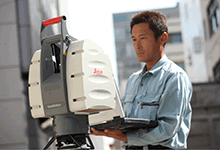
- Measurement Technology
-
Precision can be acquired based on diminishing scale, but permanent GPS monument is available anytime.
- Information Processing Technology
- Our system accumulates all essential important data (1/200000, 1/2.5million, 1/10000, based on ground map, basic country map, large scale topographical map) all data will be used in a variety of ways. In addition to providing these precise data, our expertise technicians will provide you best solutions to suit your needs.
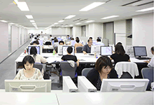
- Computer Technology
- <Server>
- Accumulate using Cloud computing, storage high server, virtual server construction, all knowledge is accumulated, and our specialists will be able to show your how to meet your needs.
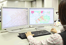
- <WebGIS>
-
We develop WebGIS which is based on server structure, technology of information process.
This is an instrolled application however will not be blocked by your firewall, supports multiple editors work simultaneously.
Coexistence of browser applications, your smart phone and tablet are allowed to see this information. We promise that the accessibility and convenience will be greatly improving. 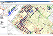
- <Develop Business application>
-
Business applications are offered by Cloud computing, ledger systems, missing person assistance system,
Especially the quality of ASP, update system on server, it will minimize your maintenance cost